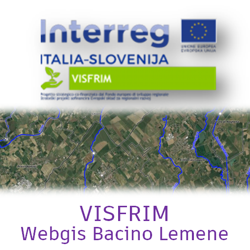
Politiche ambientali

  • project image
    SITA - Vincoli e sistemi ambientali

    Load the map View metadata

  • project image
    Ortofoto Storiche Città metropolitana di Venezia

    Load the map View metadata

Progetto CROSSIT SAFER

  • project image
    Cartography exchange project 3.2 (ENG)

    Load the map View metadata

  • project image
    Cartography exchange project 3.2 (ITA)

    Load the map View metadata

  • project image
    Cartography exchange project 3.2 (SLO)

    Load the map View metadata

Informazioni sanitarie

  • project image
    Farmacie di turno

    Load the map View metadata

Trasporti

  • project image
    conteggi

    Load the map View metadata

  • project image
    Domanda "Trasporti"

    Load the map View metadata

  • project image
    Domanda elaborazioni PUMS

    Load the map View metadata

  • project image
    Incidentalità sulle strade provinciali della CMVe

    Load the map View metadata

  • project image
    Offerta "Rete trasporti"

    Load the map View metadata

  • project image
    TPL conteggi fermate

    Load the map View metadata

Istruzione

  • project image
    Istituti di istruzione superiore

    Load the map View metadata

Piani Acque e geologia

  • project image
    Quadro d'Unione dei Piani Comunali delle Acque

    Load the map View metadata

  • project image
    Webgis Geologia

    Load the map View metadata

Venericoltura

  • project image
    Gestione Risorse Lagunari

    Load the map View metadata

Servizi al Cittadino

  • project image
    CapacityMetro Italia - Servizi per l'immigrazione e l'integrazione

    Load the map View metadata

Costruire il PAESC

  • project image
    Costruire il PAESC

    Load the map View metadata

Viabilità

  • project image
    Alberature del Città Metropolitana di Venezia

    Load the map View metadata

  • project image
    Autovelox sulle strade di competenza della Città Metropolitana di Venezia

    Load the map View metadata

  • project image
    Grafo stradale di competenza della Città Metropolitana di Venezia

    Load the map View metadata

  • project image
    Ponti mobili in gestione alla Città Metropolitana di Venezia

    Load the map View metadata

Web MApp

  • project image
    Webgis tematismi WebMapp - TURISMO

    Load the map View metadata

  • project image
    Webgis tematismi WebMapp - SOCIETÀ CIVILE

    Load the map View metadata

  • project image
    Webgis tematismi WebMapp - SICUREZZA

    Load the map View metadata

  • project image
    Webgis tematismi WebMapp - SALUTE E AMBIENTE

    Load the map View metadata

  • project image
    Webgis tematismi WebMapp - MOBILITÀ

    Load the map View metadata

  • project image
    Webgis tematismi WebMapp - CICLOVIE

    Load the map View metadata

  • project image
    Eventi POI Feratel

    Load the map View metadata

  Base Layer

project image

Title
VISFRIM - Bacino del Lemene - Webgis pubblico 

Description
Webgis VISFRIM Progetto - Bacino del Lemene 

Organization
Città Metropolitana di Venezia 

Person
Leonardo Barbiero 

E-mail
leonardo.barbiero@cittametropolitana.ve.it 

Phone
+390412501294 

Projection
EPSG:25833 

Extent
278213.36270885058911517, 5043308.44169327337294817, 392510.80887406988767907, 5113327.76954944524914026

 Locating 

 Geolocation 

 Print 

 Measures